
Map of ʻEua- Tanga
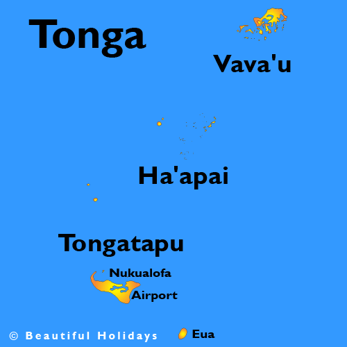
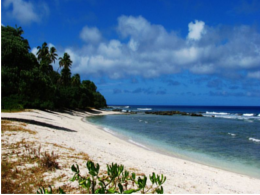
ʻEua is a smaller but still major island in the kingdom of Tonga. It is close to Tongatapu, but forms a separate administrative division. It has an area of 87.44 km2 (33.76 sq mi), and a population in 2011 of 5,016 people.
Population
ʻEua. ʻEua is a smaller but still major island in the kingdom of Tonga. It is close to Tongatapu, but forms a separate administrative division. It has an area of 87.44 km2 (33.76 sq mi), and a population in 2011 of 5,016 people.
Language
The main language spoken in the kingdom is Tongan
Currency
Geography
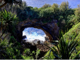
ʻEua is a hilly island, the highest peaks are the Teʻemoa (chicken manure) 312 m, with the grave of the soldier on top, and the Vaiangina (watersprings) 305 m. The island is not volcanic, but was shaped by the rubbing of the Tonga plate against the Pacific plate, pushing ʻEua up and leaving the 7-kilometre-deep (4.3 mi) Tonga trench on the bottom of the ocean, a short distance towards the east. The soil of ʻEua is volcanic, as is that of Tongatapu, but only the top layer, deposited by eruptions of nearby volcanoes ten thousands years ago. Under it are the solid rocks of pushed-up coral. ʻEua counts many huge caves and holes, not all of which have yet been explored.
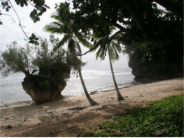
ʻEua is the only island in Tonga that has a river, and had the only bridge in the kingdom until Vavaʻu also built one. The river drains into the harbour near the capital of the island, ʻOhonua.
A unique feature is the shore between ʻOhonua and Tufuvai. It is coral reef still close to the sea level. Many small tidal pools are found, named the ʻotumatafena.
Myths

Together with ʻAta, ʻEua was the first island to be created by Tangaloa, see Tangaloa And The Story Of How ‘Eua Island Was Created.
History
ʻEua was put on the European maps by Abel Tasman who reached it and Tongatapu on 21 January 1643. He called it Middelburg Island, after the capital of the Dutch province of Zeeland. He did not go on land, but proceeded to the Hihifo district of Tongatapu, which he named Amsterdam Island after the capital of the Netherlands.