
Map of Tongatapu-Tonga
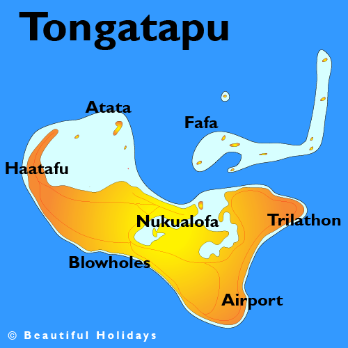
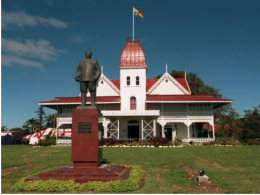
Tongatapu is the main island of the Kingdom of Tonga and the location of its capital Nukuʻalofa. It is located in Tonga's southern island group, to which it gives its name, and is the country's most populous island, with approximately 71,260 residents (2006), 70.5% of the national population, on 260 square kilometres (100 square miles). Its maximum height is 65 metres (213 feet). Tongatapu is Tonga's centre of government and the seat of its monarchy.
Tongatapu, as a commercial and transport hub, has (led by Nukuʻalofa) experienced more rapid economic development than, as well as attracting many internal migrants from, the other islands of the Kingdom.
Population: Population: 75,416 (2011)
Language: Tongan is the official language but English is very widely spoken
Currency
Currency in Tongatapu Island, Tonga is TOP (Pa'anga)

Geography
The island is 257.03 square kilometres (99.24 square miles) (or 260.48 square kilometres (100.57 square miles) including neighbouring islands) and rather flat, as it is built of coral limestone. The island is covered with thick fertile soil consisting of volcanic ash from neighboring volcanoes. At the steep coast of the south, heights reach an average of 35 metres (115 feet) gradually decreasing towards the north. Tongatapu is highest in elevation around the villages of Fua'amotu and Nakolo with a height of 65 metres (213 feet).
North of the island are many small isolated islands and coral reefs which extend up to 7 kilometres (4.3 miles) from Tongatapu's shores. The almost completely closed Fanga'uta and Fangakakau Lagoons are important breeding grounds for birds and fish as they live within the mangroves growing around the lagoon's shores. The lagoons were declared a Natural Reserve in 1974 by the government.
The island has only but a few sandy beaches because of its raised coastlines apart from the many small islands in the north boasting some of the best beaches in Tongatapu.
Climate

Tongatapu has a rather cooler climate than the rest of Tonga as it is the southernmost group of islands in the country. Because of this, fruit production is lower in Tongatapu than it is in the warmer islands in the north.
History
Tongatapu is known as having one of the highest concentration of archaeological remains in the Pacific. The earliest traces of Lapita pottery found in Tonga was from around 900–850 BCE, 300 years after the first settlements in Tonga were established. Archaeologist David Burley discovered the pottery around the Fanga'uta Lagoon, 2,000 kilometres (1,200 miles) away from the Lapita pottery found at Santa Cruz in the Solomon Islands.
Although Tonga was always the seat of the Tongan Empire, but in an area of distances up to 1,000 kilometres (620 miles), it was often only a symbolic rule. From the first capital at Toloa, around 1000 years ago, to the second capital at Heketā, at the site of the Ha'amonga 'a Maui Trilithon, none boasts more traditional attractions than the third capital at Mu'a (from 1220–1851) with more than 20 royal grave mounds.
European discovery

Tongatapu was discovered by Europeans on 20 January 1643 by Abel Janszoon Tasman commanding two ships, the Heemskerck and the Zeehaen commissioned by the Dutch East India Company of Batavia (Jakarta). The expedition's goals were to chart the unknown southern and eastern seas and to find a possible passage through the South Pacific and Indian Ocean providing a faster route to Chile. The expedition set sail from Batavia on 14 August 1642. Tasman named the island "t’ Eijlandt Amsterdam" (Amsterdam Island), because of its abundance of supplies. This name is no longer used except by historians.
Resolution, under British sea captain James Cook, stopped here in 1777 and left some cattle for breeding. These were still flourishing in 1789 when Bounty, under Fletcher Christian visited.
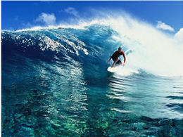
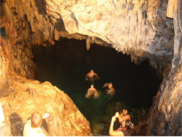
Activities

Accommodation
|
|
|
|


Flights
|
|
||


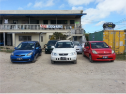
Car Rental
|
|
International Car Rentals |
|